
Ábrego topographic map
Interactive map
Click on the map to display elevation.
About this map
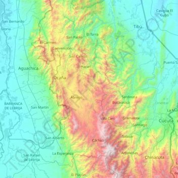
Name: Ábrego topographic map, elevation, terrain.
Location: Ábrego, Occidente, Norte de Santander, Colombia (7.44207 -73.81964 8.84207 -72.41964)
Average elevation: 798 m
Minimum elevation: 23 m
Maximum elevation: 3,928 m