
Les Buttes topographic map
Interactive map
Click on the map to display elevation.
About this map
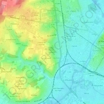
Name: Les Buttes topographic map, elevation, terrain.
Average elevation: 73 m
Minimum elevation: 41 m
Maximum elevation: 141 m
Other topographic maps
Click on a map to view its topography, its elevation and its terrain.
Le Houx
France > Pays de la Loire > Sarthe > Le Mans
Le Houx, Le Mans, Sarthe, Pays de la Loire, France métropolitaine, 72058, France
Average elevation: 63 m
Montégu
France > Pays de la Loire > Sarthe > Le Mans
Montégu, Le Mans, Sarthe, Pays de la Loire, France métropolitaine, 72700, France
Average elevation: 63 m
La Foresterie
France > Pays de la Loire > Sarthe > Le Mans > La Foresterie
La Foresterie, Le Mans, Sarthe, Pays de la Loire, France métropolitaine, 72013, France
Average elevation: 96 m