
Mildred Lake topographic map
Interactive map
Click on the map to display elevation.
About this map
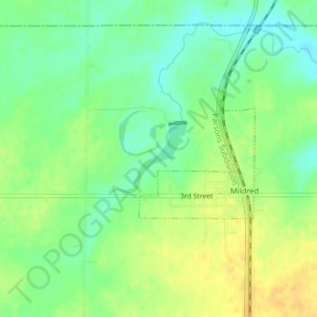
Name: Mildred Lake topographic map, elevation, terrain.
Location: Mildred Lake, Mildred, Allen County, Kansas, United States (38.02337 -95.18582 38.02941 -95.17737)
Average elevation: 320 m
Minimum elevation: 306 m
Maximum elevation: 335 m