
Thank you for supporting this site ❤️
Make a donation
Make a donation
Cloete topographic map
Click on the map to display elevation.
Thank you for supporting this site ❤️
Make a donation
Make a donation
About this map
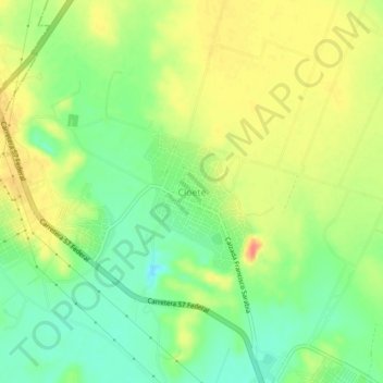
Name: Cloete topographic map, elevation, terrain.
Location: Cloete, Sabinas, Coahuila, 26700, Mexico (27.90256 -101.19571 27.94256 -101.15571)
Average elevation: 373 m
Minimum elevation: 346 m
Maximum elevation: 402 m
Thank you for supporting this site ❤️
Make a donation
Make a donation