
Crehen topographic map
Interactive map
Click on the map to display elevation.
About this map
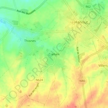
Name: Crehen topographic map, elevation, terrain.
Location: Crehen, Hannut, Waremme, Liège, Wallonie, 4280, Belgique (50.64060 5.04215 50.68060 5.08215)
Average elevation: 138 m
Minimum elevation: 115 m
Maximum elevation: 159 m
Other topographic maps
Click on a map to view its topography, its elevation and its terrain.
Lens-Saint-Remy
Belgique > Liège > Waremme > Hannut > Lens-Saint-Remy
Lens-Saint-Remy, Hannut, Waremme, Liège, Wallonie, 4280, Belgique
Average elevation: 142 m
Avernas-le-Bauduin
Belgique > Liège > Waremme > Hannut
Avernas-le-Bauduin, Hannut, Waremme, Liège, Wallonie, 4280, Belgique
Average elevation: 125 m