
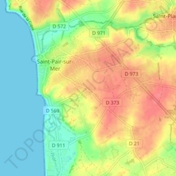
Les Troix Croix topographic map
Interactive map
Click on the map to display elevation.
About this map
Name: Les Troix Croix topographic map, elevation, terrain.
Average elevation: 27 m
Minimum elevation: 0 m
Maximum elevation: 57 m
Other topographic maps
Click on a map to view its topography, its elevation and its terrain.
Kairon
France > Normandie > Manche > Saint-Pair-sur-Mer
Kairon, Saint-Pair-sur-Mer, Avranches, Manche, Normandie, France métropolitaine, 50380, France
Average elevation: 26 m
Kairon Plage
France > Normandie > Manche > Saint-Pair-sur-Mer
Kairon Plage, Saint-Pair-sur-Mer, Avranches, Manche, Normandie, France métropolitaine, 50380, France
Average elevation: 14 m