
Pulau Sangihe Besar topographic map
Interactive map
Click on the map to display elevation.
About this map
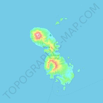
Name: Pulau Sangihe Besar topographic map, elevation, terrain.
Location: Pulau Sangihe Besar, Sulut, Indonesia (3.26333 125.21333 3.90333 125.85333)
Average elevation: 26 m
Minimum elevation: -1 m
Maximum elevation: 1,316 m
Other topographic maps
Click on a map to view its topography, its elevation and its terrain.