
Sungai Kob topographic map
Interactive map
Click on the map to display elevation.
About this map
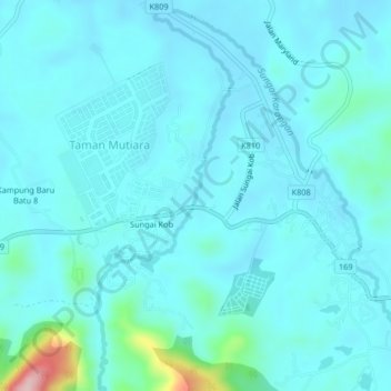
Name: Sungai Kob topographic map, elevation, terrain.
Location: Sungai Kob, Kulim, Kedah, Malaysia (5.40978 100.63870 5.45073 100.65316)
Average elevation: 52 m
Minimum elevation: 26 m
Maximum elevation: 258 m
Other topographic maps
Click on a map to view its topography, its elevation and its terrain.
Taman Tasik Putra
Taman Tasik Putra, Kulim, Kedah, Malaysia
Average elevation: 40 m
Sungai Ular
Malaysia > Kedah > Kulim > Kampung Paya Tok Betok
Sungai Ular, Kampung Paya Tok Betok, Kulim, Kedah, 09090, Malaysia
Average elevation: 43 m
Kampung Paya Tok Betok
Kampung Paya Tok Betok, Kulim, Kedah, 09090, Malaysia
Average elevation: 56 m