
Hendersonville topographic map
Interactive map
Click on the map to display elevation.
About this map
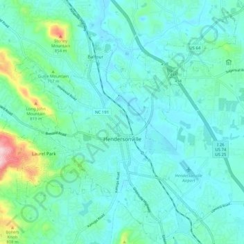
Name: Hendersonville topographic map, elevation, terrain.
Location: Hendersonville, Henderson County, North Carolina, 28738, USA (35.28829 -82.50557 35.36051 -82.40453)
Average elevation: 669 m
Minimum elevation: 624 m
Maximum elevation: 905 m