
Borgo Val di Taro topographic map
Interactive map
Click on the map to display elevation.
About this map
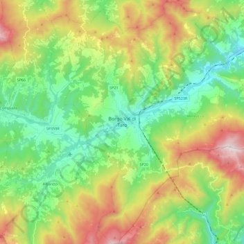
Name: Borgo Val di Taro topographic map, elevation, terrain.
Location: Borgo Val di Taro, PR, Emilia-Romagna, 43043, Italië (44.40811 9.69910 44.56607 9.90865)
Average elevation: 750 m
Minimum elevation: 316 m
Maximum elevation: 1,542 m