
Chastain Memorial Park topographic map
Interactive map
Click on the map to display elevation.
About this map
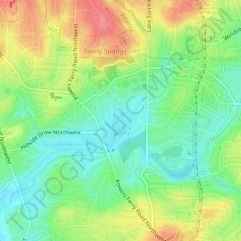
Name: Chastain Memorial Park topographic map, elevation, terrain.
Average elevation: 277 m
Minimum elevation: 245 m
Maximum elevation: 320 m
Other topographic maps
Click on a map to view its topography, its elevation and its terrain.
East Atlanta
United States > Georgia > Atlanta
East Atlanta, Atlanta, DeKalb County, Georgia, 30316, United States
Average elevation: 303 m
Cascade Heights
United States > Georgia > Atlanta > Cascade Heights
Cascade Heights, Atlanta, Georgia, 30311, United States
Average elevation: 291 m