
Les Tisses topographic map
Interactive map
Click on the map to display elevation.
About this map
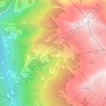
Name: Les Tisses topographic map, elevation, terrain.
Location: Les Tisses, Chandolin, Anniviers, Sierre, Valais, 3961, Suisse (46.23029 7.57699 46.27029 7.61699)
Average elevation: 1,864 m
Minimum elevation: 777 m
Maximum elevation: 2,705 m