
Bleesbréck topographic map
Interactive map
Click on the map to display elevation.
About this map
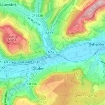
Name: Bleesbréck topographic map, elevation, terrain.
Location: Bleesbréck, Canton Diekirch, 9359, Luxembourg (49.85243 6.17070 49.89243 6.21070)
Average elevation: 271 m
Minimum elevation: 184 m
Maximum elevation: 429 m