
東北地方 topographic map
Interactive map
Click on the map to display elevation.
About this map
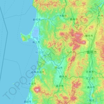
Name: 東北地方 topographic map, elevation, terrain.
Location: Prefectura de Akita, 東北地方, Japón (38.87302 139.34313 40.51112 140.99543)
Average elevation: 241 m
Minimum elevation: -5 m
Maximum elevation: 2,140 m
Other topographic maps
Click on a map to view its topography, its elevation and its terrain.