
Mont-aux-Sources topographic map
Interactive map
Click on the map to display elevation.
About this map
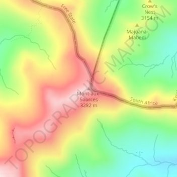
Name: Mont-aux-Sources topographic map, elevation, terrain.
Location: Mont-aux-Sources, Mokhotlong District, Lesotho (-28.77225 28.87305 -28.77215 28.87315)
Average elevation: 3,113 m
Minimum elevation: 2,950 m
Maximum elevation: 3,278 m
Other topographic maps
Click on a map to view its topography, its elevation and its terrain.
Drakensberg
Drakensberg, Mokhotlong District, Lesotho
Average elevation: 3,286 m
Tokoza (Lekeishini-le-Moyama)
Tokoza (Lekeishini-le-Moyama), Mokhotlong District, Lesotho
Average elevation: 3,039 m
Moeaneng
Moeaneng, Mokhotlong District, Lesotho
Average elevation: 2,268 m
Maputsoe
Lesotho > Mokhotlong District > Maputsoe
Maputsoe, Mokhotlong District, Lesotho
Average elevation: 2,440 m