
San Rafael las Flores topographic map
Interactive map
Click on the map to display elevation.
About this map
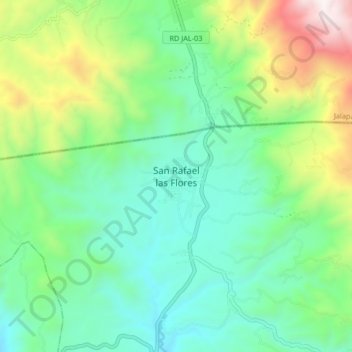
Name: San Rafael las Flores topographic map, elevation, terrain.
Location: San Rafael las Flores, Santa Rosa, Guatemala (14.43683 -90.22053 14.51683 -90.14053)
Average elevation: 1,599 m
Minimum elevation: 1,182 m
Maximum elevation: 2,637 m