
Thank you for supporting this site ❤️
Make a donation
Make a donation
Itigi topographic map
Click on the map to display elevation.
Thank you for supporting this site ❤️
Make a donation
Make a donation
About this map
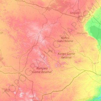
Name: Itigi topographic map, elevation, terrain.
Location: Itigi, Singida Region, Central Zone, Tanzania (-7.53682 33.48730 -5.40535 34.91349)
Average elevation: 1,233 m
Minimum elevation: 753 m
Maximum elevation: 1,851 m
Thank you for supporting this site ❤️
Make a donation
Make a donation