
Thank you for supporting this site ❤️
Make a donation
Make a donation
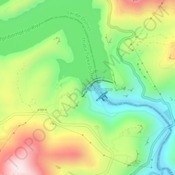
Katse Dam topographic map
Click on the map to display elevation.
Thank you for supporting this site ❤️
Make a donation
Make a donation
Katse Dam
Water from the dam first travels through a 45 kilometres (28 mi), 4 metres (13 ft) diameter tunnel, exiting at a hydroelectric station near Muela. The dam's high elevation allows a gravity flow water delivery system to South Africa, in addition to hydroelectric power for Lesotho, and was a prime reason behind the choice of site.
Thank you for supporting this site ❤️
Make a donation
Make a donation
About this map
Name: Katse Dam topographic map, elevation, terrain.
Location: Katse Dam, Thaba-Tseka District, Lesotho (-29.33943 28.50382 -29.33655 28.50967)
Average elevation: 2,108 m
Minimum elevation: 1,889 m
Maximum elevation: 2,425 m
Thank you for supporting this site ❤️
Make a donation
Make a donation
Other topographic maps
Click on a map to view its topography, its elevation and its terrain.