
Indaial topographic map
Interactive map
Click on the map to display elevation.
About this map
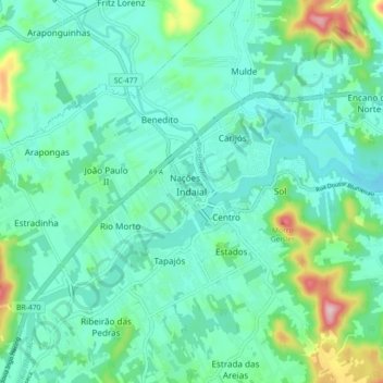
Name: Indaial topographic map, elevation, terrain.
Average elevation: 90 m
Minimum elevation: 32 m
Maximum elevation: 317 m
Indaial se situe dans la vallée du rio Itajaí, près de Blumenau, par une latitude de 26° 53′ 52″ sud et une longitude de 49° 13′ 54″ ouest, à altitude de 64 mètres. Sa population était de 54 794 habitants au recensement de 2010. La municipalité s'étend sur 431 km2.