
Thank you for supporting this site ❤️
Make a donation
Make a donation
Macieira topographic map
Click on the map to display elevation.
Thank you for supporting this site ❤️
Make a donation
Make a donation
About this map
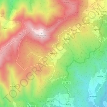
Name: Macieira topographic map, elevation, terrain.
Location: Macieira, Sul, São Pedro do Sul, Viseu, 3660-097, Portugal (40.84822 -8.07522 40.88822 -8.03522)
Average elevation: 650 m
Minimum elevation: 241 m
Maximum elevation: 1,053 m
Thank you for supporting this site ❤️
Make a donation
Make a donation