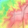
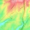
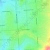
Gilberton topographic map
Click on the map to display elevation.
Gilberton
The suburb is largely flat from the river north to Walkerville Terrace, then slopes upwards to its northern extent. Due to the elevation of views from the northern section, this land attracted wealthier purchasers. Some of their ornate Victorian homes, situated on large grounds, remain there today. At a large bend in the river, the location of today's St Peters River Park, gravel extraction, sand washing and landfill have all been commercial activities. Sand washing was replaced by a dump in 1961, leading to complaints from the neighbouring suburb of St Peters about fumes from the burning rubbish. After the land was purchased by St Peters, the bend was straightened and the dump reclaimed.
About this map

Name: Gilberton topographic map, elevation, terrain.
Average elevation: 46 m
Minimum elevation: 28 m
Maximum elevation: 66 m
Other topographic maps
Click on a map to view its topography, its elevation and its terrain.
Adelaide
Australia > South Australia > Adelaide
Adelaide is north of the Fleurieu Peninsula, on the Adelaide Plains between the Gulf St Vincent and the low-lying Mount Lofty Ranges. The city stretches 20 km (12 mi) from the coast to the foothills, and 90 km (56 mi) from Gawler at its northern extent to Sellicks Beach in the south. According to the Regional…
Average elevation: 148 m


Campbelltown Re-Vegitation Community Reserve
Australia > South Australia > Adelaide
Average elevation: 91 m