
Thank you for supporting this site ❤️
Make a donation
Make a donation
Durg topographic map
Click on the map to display elevation.
Thank you for supporting this site ❤️
Make a donation
Make a donation
About this map
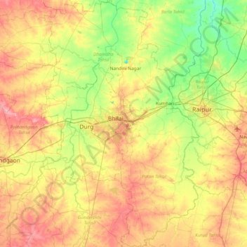
Name: Durg topographic map, elevation, terrain.
Location: Durg, Chhattisgarh, India (20.84951 81.14820 21.54485 81.62513)
Average elevation: 295 m
Minimum elevation: 255 m
Maximum elevation: 345 m
Thank you for supporting this site ❤️
Make a donation
Make a donation
Other topographic maps
Click on a map to view its topography, its elevation and its terrain.