
Kallham topographic map
Interactive map
Click on the map to display elevation.
About this map
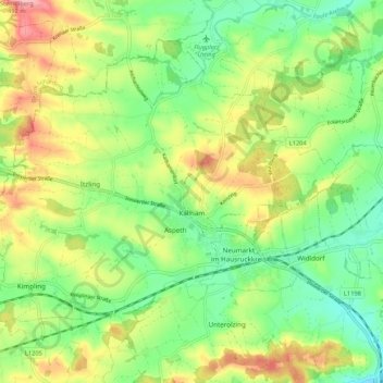
Name: Kallham topographic map, elevation, terrain.
Location: Kallham, Grieskirchen, Haute-Autriche, 4720, Autriche (48.25719 13.64749 48.31388 13.75407)
Average elevation: 411 m
Minimum elevation: 361 m
Maximum elevation: 483 m