
Thank you for supporting this site ❤️
Make a donation
Make a donation
Cuango topographic map
Click on the map to display elevation.
Thank you for supporting this site ❤️
Make a donation
Make a donation
About this map
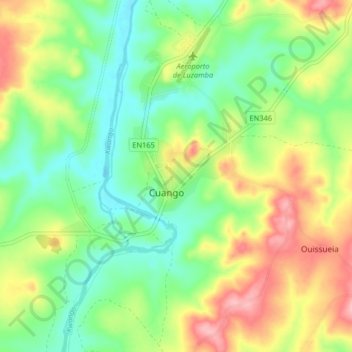
Name: Cuango topographic map, elevation, terrain.
Location: Cuango, Lunda Norte, Angola (-9.18728 18.00310 -9.10728 18.08310)
Average elevation: 856 m
Minimum elevation: 805 m
Maximum elevation: 934 m
Thank you for supporting this site ❤️
Make a donation
Make a donation
Other topographic maps
Click on a map to view its topography, its elevation and its terrain.