
Minot topographic map
Interactive map
Click on the map to display elevation.
About this map
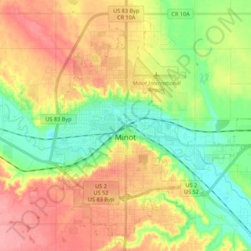
Name: Minot topographic map, elevation, terrain.
Location: Minot, Ward County, North Dakota, USA (48.19164 -101.34295 48.28304 -101.18767)
Average elevation: 510 m
Minimum elevation: 467 m
Maximum elevation: 558 m