
Hidaka topographic map
Interactive map
Click on the map to display elevation.
About this map
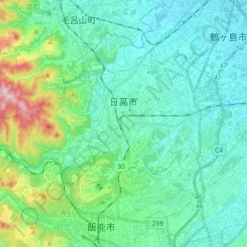
Name: Hidaka topographic map, elevation, terrain.
Location: Hidaka, 3501203, Japan (35.86817 139.27540 35.92826 139.40205)
Average elevation: 105 m
Minimum elevation: 33 m
Maximum elevation: 401 m