
Make a donation
Rosedale topographic map
Click on the map to display elevation.
Make a donation
About this map
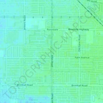
Name: Rosedale topographic map, elevation, terrain.
Location: Rosedale, Kern County, California, United States (35.37623 -119.14581 35.37924 -119.14554)
Average elevation: 113 m
Minimum elevation: 109 m
Maximum elevation: 116 m
Make a donation
Other topographic maps
Click on a map to view its topography, its elevation and its terrain.
Ridgecrest
United States > California > Kern County
Walker Pass (elevation 5,250 ft (1.60 km)) is a mountain pass by Lake Isabella in the southern Sierra Nevada mountains. It is located in northeastern Kern County, approximately 53 mi (85 km) ENE of Bakersfield and 10 mi (16 km) WSW of Ridgecrest. The pass provides a route between the San Joaquin Valley on the…
Average elevation: 739 m
Rosamond
United States > California > Kern County
Rosamond sits in the northern end of the Antelope Valley, the westernmost valley of the Mojave Desert. Because the elevation is 2,000 to 3,000 feet (610 to 910 m) above sea level, the area, like the other parts of the Mojave Desert region, is referred to as the High Desert. Some cities and communities within…
Average elevation: 749 m