
Thank you for supporting this site ❤️
Make a donation
Make a donation
Meragang topographic map
Click on the map to display elevation.
Thank you for supporting this site ❤️
Make a donation
Make a donation
About this map
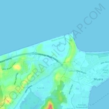
Name: Meragang topographic map, elevation, terrain.
Location: Meragang, Mukim Serasa, Brunei-Muara District, Brunei (5.02744 115.01265 5.04585 115.05880)
Average elevation: 9 m
Minimum elevation: 0 m
Maximum elevation: 86 m
Thank you for supporting this site ❤️
Make a donation
Make a donation
Other topographic maps
Click on a map to view its topography, its elevation and its terrain.