
Marshfield Hills topographic map
Interactive map
Click on the map to display elevation.
About this map
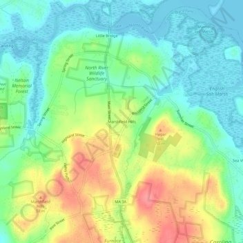
Name: Marshfield Hills topographic map, elevation, terrain.
Average elevation: 29 m
Minimum elevation: -2 m
Maximum elevation: 78 m
Other topographic maps
Click on a map to view its topography, its elevation and its terrain.
Ocean Bluff
United States > Massachusetts > Plymouth County > Marshfield
Ocean Bluff, Marshfield, Plymouth County, Massachusetts, United States
Average elevation: 3 m
Kent Park
United States > Massachusetts > Plymouth County > Marshfield
Kent Park, Marshfield, Plymouth County, Massachusetts, 02050, United States
Average elevation: 13 m