
Ga-Mokgwathi topographic map
Click on the map to display elevation.
About this map
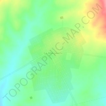
Name: Ga-Mokgwathi topographic map, elevation, terrain.
Average elevation: 495 m
Minimum elevation: 462 m
Maximum elevation: 554 m
Other topographic maps
Click on a map to view its topography, its elevation and its terrain.
Tzaneen Dam
South Africa > Limpopo > Mopani District Municipality > Greater Tzaneen Local Municipality
Average elevation: 721 m
Dap Naudé Dam
South Africa > Limpopo > Mopani District Municipality > Greater Tzaneen Local Municipality
Average elevation: 1,635 m
Ebenezer Dam
South Africa > Limpopo > Mopani District Municipality > Greater Tzaneen Local Municipality > Haenertsburg
Average elevation: 1,387 m
Tzaneen Dam
South Africa > Limpopo > Mopani District Municipality > Greater Tzaneen Local Municipality
Average elevation: 721 m