
Thank you for supporting this site ❤️
Make a donation
Make a donation
Sapelo Island topographic map
Click on the map to display elevation.
Thank you for supporting this site ❤️
Make a donation
Make a donation
About this map
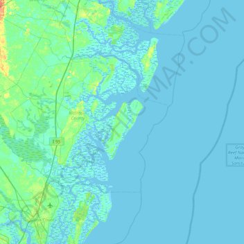
Name: Sapelo Island topographic map, elevation, terrain.
Location: Sapelo Island, McIntosh County, Georgia, United States (31.15745 -81.56176 31.79745 -80.92176)
Average elevation: 2 m
Minimum elevation: -4 m
Maximum elevation: 29 m
Thank you for supporting this site ❤️
Make a donation
Make a donation
Other topographic maps
Click on a map to view its topography, its elevation and its terrain.