
Thank you for supporting this site ❤️
Make a donation
Make a donation
Radom topographic map
Click on the map to display elevation.
Thank you for supporting this site ❤️
Make a donation
Make a donation
About this map
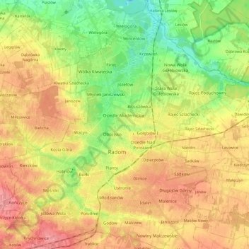
Name: Radom topographic map, elevation, terrain.
Location: Radom, Masovian Voivodeship, Poland (51.34862 21.05319 51.48586 21.25907)
Average elevation: 168 m
Minimum elevation: 127 m
Maximum elevation: 206 m
Thank you for supporting this site ❤️
Make a donation
Make a donation