
Corbières topographic map
Interactive map
Click on the map to display elevation.
About this map
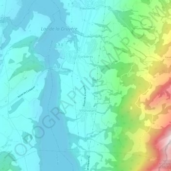
Name: Corbières topographic map, elevation, terrain.
Location: Corbières, District de la Gruyère, Fribourg, Suisse (46.63363 7.08855 46.66919 7.14732)
Average elevation: 841 m
Minimum elevation: 663 m
Maximum elevation: 1,496 m
Other topographic maps
Click on a map to view its topography, its elevation and its terrain.
Lac de Gruyère
Lac de Gruyère, Chemin de la Montagnetta, Corbières, District de la Gruyère, Fribourg, 1647, Suisse
Average elevation: 891 m