
Thank you for supporting this site ❤️
Make a donation
Make a donation
Creighton topographic map
Click on the map to display elevation.
Thank you for supporting this site ❤️
Make a donation
Make a donation
About this map
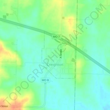
Name: Creighton topographic map, elevation, terrain.
Location: Creighton, Cass County, Missouri, United States (38.49132 -94.07739 38.50281 -94.06691)
Average elevation: 248 m
Minimum elevation: 233 m
Maximum elevation: 275 m
Thank you for supporting this site ❤️
Make a donation
Make a donation