
Pitet topographic map
Interactive map
Click on the map to display elevation.
About this map
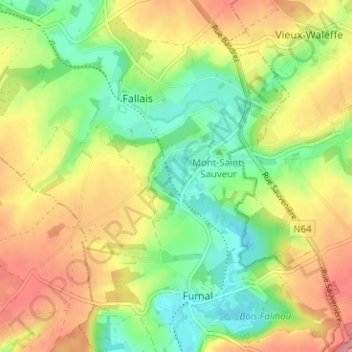
Name: Pitet topographic map, elevation, terrain.
Location: Pitet, Braives, Waremme, Liège, Wallonie, 4260, Belgique (50.58042 5.16046 50.62042 5.20046)
Average elevation: 141 m
Minimum elevation: 98 m
Maximum elevation: 189 m
Other topographic maps
Click on a map to view its topography, its elevation and its terrain.