
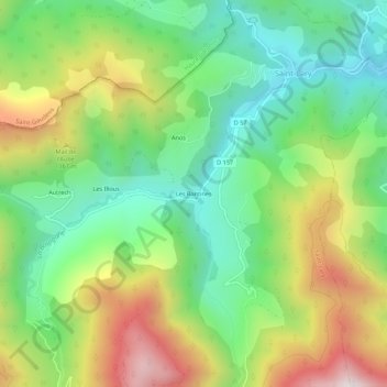
Les Bantines topographic map
Interactive map
Click on the map to display elevation.
About this map
Name: Les Bantines topographic map, elevation, terrain.
Average elevation: 993 m
Minimum elevation: 659 m
Maximum elevation: 1,530 m
Other topographic maps
Click on a map to view its topography, its elevation and its terrain.
Autrech
France > Occitanie > Ariège > Saint-Lary
Autrech, Saint-Lary, Saint-Girons, Ariège, Occitanie, France métropolitaine, 09800, France
Average elevation: 1,090 m
Les Illous
France > Occitanie > Ariège > Saint-Lary > Les Illous
Les Illous, Saint-Lary, Saint-Girons, Ariège, Occitanie, France métropolitaine, 09800, France
Average elevation: 1,037 m