
Dillo topographic map
Interactive map
Click on the map to display elevation.
About this map
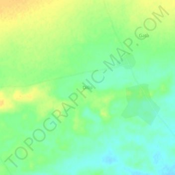
Name: Dillo topographic map, elevation, terrain.
Location: Dillo, Dakoro, Maradi, Niger (14.84868 7.29640 14.88868 7.33640)
Average elevation: 422 m
Minimum elevation: 409 m
Maximum elevation: 436 m
Other topographic maps
Click on a map to view its topography, its elevation and its terrain.