
Province de Fianarantsoa topographic map
Interactive map
Click on the map to display elevation.
About this map
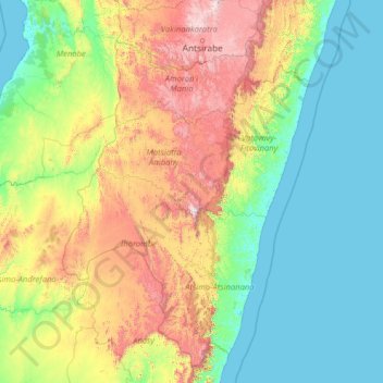
Name: Province de Fianarantsoa topographic map, elevation, terrain.
Location: Province de Fianarantsoa, Madagascar (-24.51742 44.27099 -19.31742 49.47099)
Average elevation: 451 m
Minimum elevation: -1 m
Maximum elevation: 2,533 m