
Thank you for supporting this site ❤️
Make a donation
Make a donation
Selayun topographic map
Click on the map to display elevation.
Thank you for supporting this site ❤️
Make a donation
Make a donation
About this map
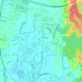
Name: Selayun topographic map, elevation, terrain.
Location: Selayun, Mukim Sengkurong, Brunei-Muara District, Brunei (4.89354 114.84506 4.91804 114.86468)
Average elevation: 23 m
Minimum elevation: 2 m
Maximum elevation: 92 m
Thank you for supporting this site ❤️
Make a donation
Make a donation
Other topographic maps
Click on a map to view its topography, its elevation and its terrain.