
Launceston topographic map
Click on the map to display elevation.
About this map
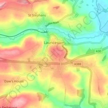
Name: Launceston topographic map, elevation, terrain.
Location: Launceston, Cornwall, England, United Kingdom (50.61238 -4.39052 50.65207 -4.32710)
Average elevation: 119 m
Minimum elevation: 49 m
Maximum elevation: 192 m
Other topographic maps
Click on a map to view its topography, its elevation and its terrain.