
Radda in Chianti topographic map
Interactive map
Click on the map to display elevation.
About this map
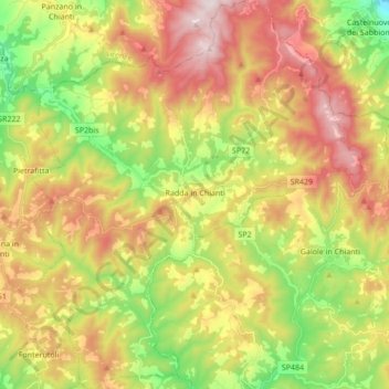
Name: Radda in Chianti topographic map, elevation, terrain.
Location: Radda in Chianti, Siena, Toscane, 53017, Italië (43.42444 11.29684 43.54856 11.44861)
Average elevation: 484 m
Minimum elevation: 144 m
Maximum elevation: 863 m