
Anaktuvuk Pass topographic map
Interactive map
Click on the map to display elevation.
About this map
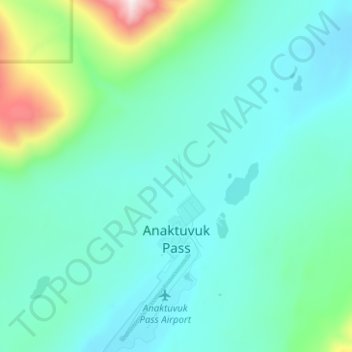
Name: Anaktuvuk Pass topographic map, elevation, terrain.
Average elevation: 727 m
Minimum elevation: 605 m
Maximum elevation: 1,439 m
Other topographic maps
Click on a map to view its topography, its elevation and its terrain.
Point Barrow
Estados Unidos da América > Alasca > North Slope
Point Barrow, North Slope, Alasca, Estados Unidos da América
Average elevation: 0 m
Prudhoe Bay
Estados Unidos da América > Alasca > North Slope
Prudhoe Bay, North Slope, Alasca, 99734, Estados Unidos da América
Average elevation: 10 m