
Thank you for supporting this site ❤️
Make a donation
Make a donation
Hatillo topographic map
Click on the map to display elevation.
Thank you for supporting this site ❤️
Make a donation
Make a donation
About this map
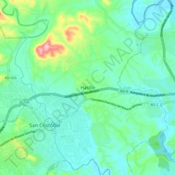
Name: Hatillo topographic map, elevation, terrain.
Location: Hatillo, San Cristóbal, 91000, República Dominicana (18.39463 -70.12966 18.47463 -70.04966)
Average elevation: 61 m
Minimum elevation: 8 m
Maximum elevation: 256 m
Thank you for supporting this site ❤️
Make a donation
Make a donation