
Rogers Ledge topographic map
Interactive map
Click on the map to display elevation.
About this map
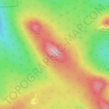
Name: Rogers Ledge topographic map, elevation, terrain.
Location: Rogers Ledge, Kilkenny, Coös County, New Hampshire, USA (44.54987 -71.36229 44.54997 -71.36219)
Average elevation: 735 m
Minimum elevation: 589 m
Maximum elevation: 876 m