
Zabeln topographic map
Interactive map
Click on the map to display elevation.
About this map
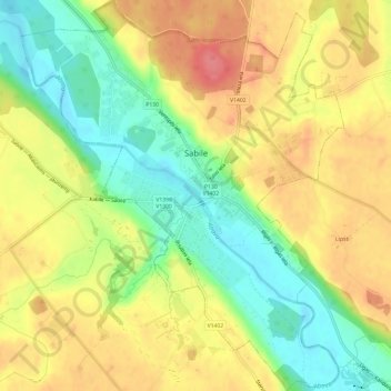
Name: Zabeln topographic map, elevation, terrain.
Location: Zabeln, Talsu novads, Kurland, LV-3294, Lettland (57.02837 22.54407 57.06108 22.59392)
Average elevation: 66 m
Minimum elevation: 27 m
Maximum elevation: 102 m
Other topographic maps
Click on a map to view its topography, its elevation and its terrain.
Zabeln
Lettland > Kurland > Talsu novads
Zabeln, Talsu novads, Kurland, Lettland
Average elevation: 73 m