
Elsmore topographic map
Interactive map
Click on the map to display elevation.
About this map
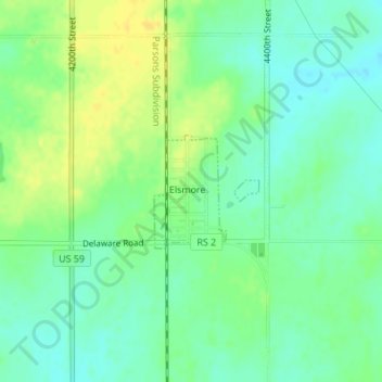
Name: Elsmore topographic map, elevation, terrain.
Location: Elsmore, Allen County, Kansas, United States (37.79033 -95.15323 37.79834 -95.14384)
Average elevation: 322 m
Minimum elevation: 311 m
Maximum elevation: 334 m
Other topographic maps
Click on a map to view its topography, its elevation and its terrain.
Humboldt
United States > Kansas > Allen County
Humboldt, Allen County, Kansas, United States
Average elevation: 293 m
Bassett
United States > Kansas > Allen County
Bassett, Allen County, Kansas, United States
Average elevation: 294 m
Gas
United States > Kansas > Allen County
Gas, Allen County, Kansas, 66742, United States
Average elevation: 310 m
Savonburg
United States > Kansas > Allen County
Savonburg, Allen County, Kansas, United States
Average elevation: 318 m
Moran
United States > Kansas > Allen County
Moran, Allen County, Kansas, United States
Average elevation: 334 m
Iola
United States > Kansas > Allen County
Iola, Allen County, Kansas, 66749, United States
Average elevation: 296 m
La Harpe
United States > Kansas > Allen County
La Harpe, Allen County, Kansas, 66751, United States
Average elevation: 313 m