
Closel Bourbon topographic map
Interactive map
Click on the map to display elevation.
About this map
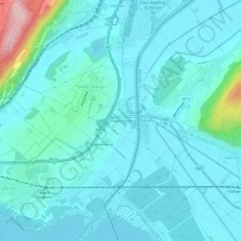
Name: Closel Bourbon topographic map, elevation, terrain.
Location: Closel Bourbon, Thielle-Wavre, La Tène, Neuchâtel, 2075, Suisse (47.00027 7.00919 47.04027 7.04919)
Average elevation: 454 m
Minimum elevation: 422 m
Maximum elevation: 659 m