
Thank you for supporting this site ❤️
Make a donation
Make a donation
Ochtrup topographic map
Click on the map to display elevation.
Thank you for supporting this site ❤️
Make a donation
Make a donation
About this map
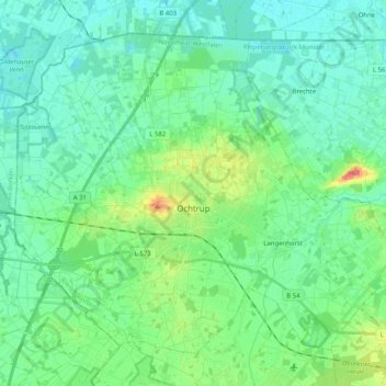
Name: Ochtrup topographic map, elevation, terrain.
Location: Ochtrup, Kreis Steinfurt, Noordrijn-Westfalen, 48607, Duitsland (52.16370 7.09468 52.26638 7.29675)
Average elevation: 49 m
Minimum elevation: 34 m
Maximum elevation: 98 m
Thank you for supporting this site ❤️
Make a donation
Make a donation
Other topographic maps
Click on a map to view its topography, its elevation and its terrain.
Isendorf-Beckwermert
Duitsland > Noordrijn-Westfalen > Kreis Steinfurt > Emsdetten
Average elevation: 42 m
Leeden
Duitsland > Noordrijn-Westfalen > Kreis Steinfurt > Tecklenburg > Leeden
Average elevation: 104 m
Thank you for supporting this site ❤️
Make a donation
Make a donation