
Pouget topographic map
Interactive map
Click on the map to display elevation.
About this map
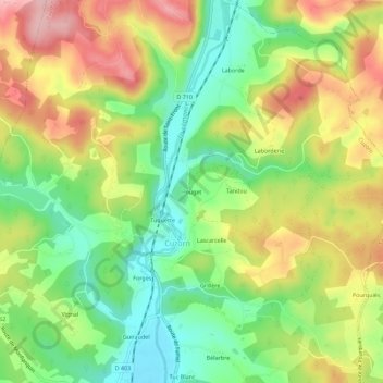
Name: Pouget topographic map, elevation, terrain.
Average elevation: 155 m
Minimum elevation: 80 m
Maximum elevation: 245 m
Other topographic maps
Click on a map to view its topography, its elevation and its terrain.
Laborde
France > Nouvelle-Aquitaine > Lot-et-Garonne > Cuzorn
Laborde, Cuzorn, Villeneuve-sur-Lot, Lot-et-Garonne, Nouvelle-Aquitaine, France métropolitaine, 47500, France
Average elevation: 167 m
Tuquette
France > Nouvelle-Aquitaine > Lot-et-Garonne > Cuzorn
Tuquette, Cuzorn, Villeneuve-sur-Lot, Lot-et-Garonne, Nouvelle-Aquitaine, France métropolitaine, 47500, France
Average elevation: 150 m