
Thank you for supporting this site ❤️
Make a donation
Make a donation
Lands End topographic map
Click on the map to display elevation.
Thank you for supporting this site ❤️
Make a donation
Make a donation
About this map
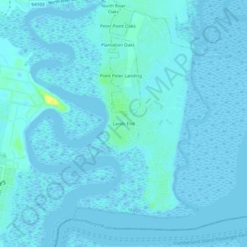
Name: Lands End topographic map, elevation, terrain.
Location: Lands End, St. Marys, Camden County, Georgia, United States (30.71996 -81.54148 30.75996 -81.50148)
Average elevation: 2 m
Minimum elevation: -6 m
Maximum elevation: 21 m
Thank you for supporting this site ❤️
Make a donation
Make a donation